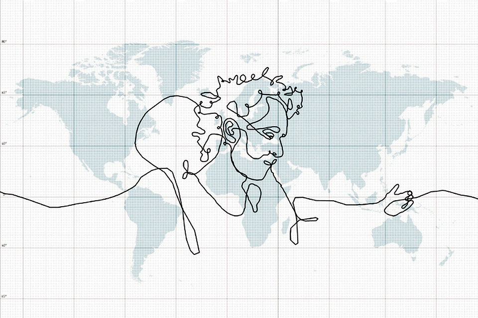
GPS drawing is a method of drawing that uses Global Positioning System technology (GPS) to create large-scale artwork. It combines art, movement, and technology.
GPS drawing is a relatively new discipline, whose boom is related to the development of technology and its availability. GPS receivers determine one’s position on the surface of the Earth by trilateration of microwave signals from satellites orbiting at an altitude of 20,200 km. Tracks of a journey can automatically be recorded into the GPS receiver’s memory and can subsequently be downloaded onto a computer as a basis for drawing, sculpture or animation. This journey may be on the surface (e.g. walking) or taken in 3D (e.g. while flying).
GPS drawing is a relatively new type of activity at the interface of entertainment, sports and art. The principle is to record your current location using a GPS device, usually when walking, running or cycling. Typically, a mobile phone is needed in conjunction with a mapping application. The trajectories thus created create patterns and, thanks to careful planning of the route, can create inscriptions, simple or even complex drawings.
Technology:
The GPS does not require the user to transmit any data, and it operates independently of any telephonic or internet reception, though these technologies can enhance the usefulness of the GPS positioning information. The GPS provides critical positioning capabilities to military, civil, and commercial users around the world. The United States government created the system, maintains it, and makes it freely accessible to anyone with a GPS receiver.
Due in part to regulations encouraging mobile phone tracking, the majority of GPS receivers are built into mobile telephones, with varying degrees of coverage and user accessibility. Commercial navigation software is available for most 21st-century smartphones as well as some Java-enabled phones that allows them to use an internal or external GPS receiver (in the latter case, connecting via serial or Bluetooth).
GPS navigation applications for mobile phones include on-line (e.g. Waze, Google Maps Navigation, Apple Maps) and off-line (e.g. iGo for Android, Maverick and HERE for Windows Phone) navigation applications. Google Maps Navigation, which is included with Android, means most smartphone users only need their phone to have a personal navigation assistant.
Many Android smartphones have an additional GPS feature, called Extended Prediction Orbit (EPO). The phone downloads a file to help it locate GPS satellites.
A track is a trace of somewhere that you have actually been (often called a “breadcrumb trail”). The GPS unit (external or internal) periodically sends details of the location which are recorded by the software, either by taking a reading based on a set time interval, based on a set distance, based on a change in direction by more than a certain angle, or a combination of these. Each point is stored together with its date and time. The resulting track can be displayed as a series of the recorded points or a line connecting them.
A route is a preset series of points that make up a set route to follow for your destination. Most software allows the route and the track to be displayed at the same time.
Waypoints are used to mark particular locations, typically used as markers along the “way” to somewhere. They are either key entered by users or downloaded from other sources, depending upon the sophistication of the device. Although not linked to tracks or routes, they can be used to simplify the construction of routes, by being able to be re-used. Frequently, waypoints serve a “safety” purpose, enabling a route to be taken around obstacles such as shallow water (marine navigation) or streams/cliffs/other hazards which may prevent a safe passage directly from point “A” to point “B”.
Examples:
The idea was first implemented by artists Hugh Pryor and Jeremy Wood, whose work includes a 13-mile wide fish in Oxfordshire, spiders with legs 21 miles long in Port Meadow, Oxford, and “the world’s biggest ‘IF'”: a pair of letters, “I”, which goes from Iffley in Oxford to Southampton and back, and “F” which traverses through the Ifield Road in London down to Iford, East Sussex, through Iford and back up through Ifold in West Sussex. The total length is 537 km, and the height of the drawing in typographic units is 319,334,400 points. Typical computer fonts at standard resolutions are between 8 and 12 points.
Decade later, GPS drawing is perceived as a fairly widespread entertainment.
The largest GPS drawing recorded in the Guinness Book of Records is the Yasushi Takahasi from Japan, which produced the “Take Me” inscription 7163.67 km across Japan. The record was recorded on June 9, 2010. In 2008, the media also recorded a GPS drawing across the globe, allegedly taken with a courier delivery package. It was, however, a whip of a Swedish artist Erik Nordenankar as an art advertiser.
In early 2014 programmer Joe Rosen released a GPS-A-Sketch GPS sketching app for iOS, through the iTunes App Store.
In 2016, musicians Shaun Buswell & Erik Nyberg travelled around the United Kingdom drawing a 400+ mile penis across England and Scotland.
